
Επιμέλεια : Δημήτρης Καραγεωργίου
NEW PRODUCT RELEASE
Humminbird® Supersizes HELIX™ 12 Features for 2017
CHIRP, Bluetooth®, AutoChart® Live features and MEGA Imaging™ technologies come to second generation HELIX™ 12 family
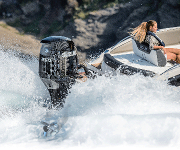
New for 2017, the Humminbird® HELIX™ 12 has been supersized with additional features and technologies, including CHIRP digital sonar, CHIRP Side Imaging®, CHIRP Down Imaging®, Bluetooth®, expanded AutoChart® functionality with vegetation and bottom hardness mapping, and the groundbreaking MEGA Imaging™.
“With the HELIX™ 12 CHIRP G2N models we set out to redefine what a professional-grade fish-finder can do,” comments Ray Schaffart, Humminbird® Brand Manager. “It’s a complete arsenal of fish-finding power unlike anything we’ve ever introduced.
“We’ve added variable CHIRP frequency ranges for both Side Imaging® and Down Imaging® - in addition to our CHIRP digital sonar - resulting in unparalleled target separation. Plus, the new G2N SI model features MEGA Imaging™, which is going to set the industry standard for clarity and detail. Anglers won’t believe what they are seeing…or what they’ve been missing.”
Available this December, new units also feature Bluetooth® to sync with smartphones, showing text messages and missed calls right on your Humminbird display.
Additionally, a 2017 feature addition includes an improved AutoChart® Live that allows for vegetation and bottom hardness contour mapping. Prior to the addition of bottom hardness and vegetation charting, AutoChart Live gave anglers the ability to map the depth contour of any body of water for their own unique map.
“The addition of vegetation and bottom hardness mapping completes a trifecta of information-packed AutoChart® Live layers. In addition to lake depths contours, anglers can now precisely map weedlines, and even follow them with Minn Kota® i-Pilot® Link™ models. The same goes for bottom hardness transitions. These areas serve as a super-highway for many fish species and now they are in reach. Watching what anglers do with this technology is going be really exciting” says Schaffart.
HELIX™ 12 CHIRP SI GPS G2N
• The flagship unit of the HELIX™ 12 G2N family features CHIRP digital sonar, GPS chart plotting with internal GPS receiver, MEGA CHIRP Down Imaging®, and MEGA CHIRP Side Imaging®
• Bluetooth® enabled to show missed calls and messages on the screen when linked to a smartphone
• Comes pre-loaded with AutoChart® Live for up to 8-hours of immediate user-generated mapping, including vegetation, bottom hardness and depth contour mapping. Additional storage is available on an optional AutoChart® Zero Line map card
• Offers CHIRP digital sonar and GPS chart plotting with internal GPS receiver for 2,500 waypoints, 45 routes, 50 tracks and 20,000 waypoints
• Navionics® Gold/HotMaps™ compatible
• Water surface temperature gauge built into transducer for finding fish-holding locations
• GPS speed included
• 1500 feet depth-capable sonar; Down Imaging®, 350 feet; Side imaging®, 100 feet, left and right
HELIX™ 12 CHIRP DI GPS G2N
• Functionality includes CHIRP digital sonar, CHIRP Down Imaging®, and GPS chartplotting with internal GPS receiver
• Comes pre-loaded with AutoChart® Live for up to 8-hours of immediate user-generated mapping, including vegetation, bottom hardness and depth contour mapping. Additional storage is available on an optional AutoChart® Zero Line map card
• Offers CHIRP digital sonar and GPS chart plotting with internal GPS receiver for 2,500 waypoints, 45 routes, 50 tracks and 20,000 waypoints
• Navionics® Gold/HotMaps™ compatible
• Water surface temperature gauge built into transducer for finding fish-holding locations
• GPS speed included
• 600 feet depth-capable sonar; Down Imaging®, 350 feet
HELIX™ 12 CHIRP GPS G2N
• Offers CHIRP digital sonar and GPS chart plotting with internal GPS receiver for 2,500 waypoints, 45 routes, 50 tracks and 20,000 waypoints
• Comes pre-loaded with AutoChart® Live for up to 8-hours of immediate user-generated mapping, including vegetation, bottom hardness and depth contour mapping. Additional storage is available on an optional AutoChart® Zero Line map card
• Navionics® Gold/HotMaps™ compatible
• Water surface temperature gauge built into transducer for finding fish-holding locations
• GPS speed included
• 1,500 feet depth capability
For sales information:
Motocraft SA
Alimou Ave. 48
17455 Alimos
phone 210 9888288
email: motocraft@motocraft.gr